San Rafael (Iloilo)
| Municipality of San Rafael | |||
 Bergstraße | |||
_Municipal_Seal.png) | |||
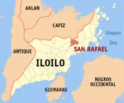
| Lage von in der Provinz Iloilo | |||
|---|---|---|---|
| |||
| Basisdaten | |||
| Region: | Western Visayas | ||
| Provinz: | Iloilo | ||
| Barangays: | 9 | ||
| Distrikt: | 5. Distrikt von Iloilo | ||
| PSGC: | 063042000 | ||
| Einkommensklasse: | 4. Einkommensklasse | ||
| Haushalte: | 4340 Zensus 1. Mai 2000
| ||
| Einwohnerzahl: | 16.532 Zensus 1. August 2015
| ||
| Einwohnerdichte: | 246,6 Einw. je km² | ||
| Fläche: | 67,05 km² | ||
| Koordinaten: | 11° 10′ N, 122° 50′ O | ||
| Postleitzahl: | 5039 | ||
| Vorwahl: | +63 (0) 33 | ||
| Bürgermeister: | Roberto T. Belleza Jr. | ||
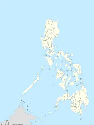
| Geographische Lage auf den Philippinen | |||
| |||
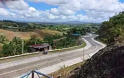
San Rafael ist eine philippinische Stadtgemeinde in der Provinz Iloilo. Sie hat 16.532 Einwohner (Zensus 1. August 2015).
Baranggays
San Rafael ist politisch in neun Barangays unterteilt.
- Aripdip
- Bagacay
- Calaigang
- Ilongbukid
- Poscolon
- San Andres
- San Dionisio
- San Florentino
- Poblacion
Weblinks
- elgu.ncc.gov.ph - San Rafael ( vom 9. November 2007 im Internet Archive)