Manitoba Census Division No. 19
| Division No. 19 | |
|---|---|
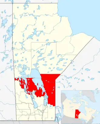 Lage der Region in Manitoba
| |
| Basisdaten | |
| Staat | Kanada |
| Provinz | Manitoba
|
| Koordinaten: | 51° 59′ N, 97° 32′ W |
| Einwohner | 16.518 (Stand: 2016[1]) |
| Fläche | 61.219 km² |
| Bevölkerungsdichte | 0,3 Einw./km² |
| Zeitzone: | Central Standard Time (UTC−6) Central Daylight Time (UTC−5, Sommerzeit) |
Die Census Division No. 19 in der kanadischen Provinz Manitoba gehört zur North Region. Sie hat eine Fläche von 61.219 km² und 16.518 Einwohner (Stand: 2016). 2011 betrug die Einwohnerzahl 17.240.[2]
Census Subdivisions
Im Folgenden die "Census Subdivisions" („Zensus-Untergliederungen“) der Division No. 19 mit Stand vom Census 2016.[3]
- Berens River 13 (Indian reserve)
- Black River 9 (Indian reserve)
- Bloodvein 12 (Indian reserve)
- Chemawawin 3 (Indian reserve)
- Crane River 51 (Indian reserve)
- Dauphin River 48A (Indian reserve)
- Division No. 19, Unorganized (Unorganized)
- Fairford (Part) 50 (Indian reserve)
- Fisher River 44 (Indian reserve)
- Fisher River 44A (Indian reserve)
- Fort Alexander 3 (Indian reserve)
- Hole or Hollow Water 10 (Indian reserve)
- Jackhead 43 (Indian reserve)
- Little Grand Rapids 14 (Indian reserve)
- Pauingassi First Nation (Indian reserve)
- Peguis 1B (Indian reserve)
- Pine Creek 66A (Indian reserve)
- Poplar River 16 (Indian reserve)
- Shoal River Indian Reserve 65A (Indian reserve)
- Swan Lake 65C (Indian reserve)
- The Narrows 49 (Indian reserve)
- Waterhen 45 (Indian reserve)
Einzelnachweise
- ↑ Statistics Canada: Census Profile, 2016 Census – Division No. 19, Census division (Census division), Manitoba and Alberta (Province), abgerufen am 15. Mai 2021
- ↑ Statistics Canada: Census 2011. Archiviert vom (nicht mehr online verfügbar) am 22. März 2014; abgerufen am 29. Juli 2012 (englisch). Info: Der Archivlink wurde automatisch eingesetzt und noch nicht geprüft. Bitte prüfe Original- und Archivlink gemäß Anleitung und entferne dann diesen Hinweis.
- ↑ Geographic hierarchy 1: Division No. 19, Census division [Census division], Manitoba. In: Geographic hierarchies, Census Profile, 2016 Census. Statistics Canada, abgerufen am 20. Juli 2025 (englisch).
Weblinks
- Census Profile: Census Division No. 19, Manitoba; Statistics Canada
- Census Profile: Karte Census Division No. 19, Manitoba; Statistics Canada
Division No. 1 | Division No. 2 | Division No. 3 | Division No. 4 | Division No. 5 | Division No. 6 | Division No. 7 | Division No. 8 | Division No. 9 | Division No. 10 | Division No. 11 | Division No. 12 | Division No. 13 | Division No. 14 | Division No. 15 | Division No. 16 | Division No. 17 | Division No. 18 | | Division No. 20 | Division No. 21 | Division No. 22 | Division No. 23