Manitoba Census Division No. 15
| Division No. 15 | |
|---|---|
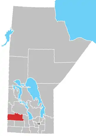 Lage der Region in Manitoba
| |
| Basisdaten | |
| Staat | Kanada |
| Provinz | Manitoba
|
| Koordinaten: | 50° 23′ N, 100° 29′ W |
| Einwohner | 21.379 (Stand: 2016[1]) |
| Fläche | 9.326,6 km² |
| Bevölkerungsdichte | 2,3 Einw./km² |
| Zeitzone: | Central Standard Time (UTC−6) Central Daylight Time (UTC−5, Sommerzeit) |
Die Census Division No. 15 in der kanadischen Provinz Manitoba gehört zur Southwest Region. Sie hat eine Fläche von 9326,6 km² und 21.379 Einwohner (Stand: 2016). 2011 betrug die Einwohnerzahl 21.604.[2]
Census Subdivisions
Im Folgenden die "Census Subdivisions" („Zensus-Untergliederungen“) der Division No. 15 mit Stand vom Census 2016.[3]
- Birdtail Creek 57 (Indian reserve)
- Clanwilliam-Erickson (Municipality)
- Ellice-Archie (Rural municipality)
- Gambler 63 (Part) (Indian reserve)
- Hamiota (Municipality)
- Harrison Park (Municipality)
- Keeseekoowenin 61 (Indian reserve)
- Minnedosa (Town)
- Minto-Odanah (Municipality)
- Neepawa (Town)
- Oakview (Rural municipality)
- Prairie View (Municipality)
- Rolling River 67 (Indian reserve)
- Rolling River 67B (Indian reserve)
- Rosedale (Rural municipality)
- Yellowhead (Rural municipality)
Einzelnachweise
- ↑ Statistics Canada: Census Profile, 2016 Census – Division No. 15, Census division (Census division), Manitoba and Alberta (Province), abgerufen am 15. Mai 2021
- ↑ Statistics Canada: Census 2011. Abgerufen am 29. Juli 2012 (englisch).
- ↑ Geographic hierarchy 1: Division No. 15, Census division [Census division], Manitoba. In: Geographic hierarchies, Census Profile, 2016 Census. Statistics Canada, abgerufen am 20. Juli 2025 (englisch).
Weblinks
- Census Profile: Census Division No. 15, Manitoba; Statistics Canada
- Census Profile: Karte Census Division No. 15, Manitoba; Statistics Canada
Division No. 1 | Division No. 2 | Division No. 3 | Division No. 4 | Division No. 5 | Division No. 6 | Division No. 7 | Division No. 8 | Division No. 9 | Division No. 10 | Division No. 11 | Division No. 12 | Division No. 13 | Division No. 14 | | Division No. 16 | Division No. 17 | Division No. 18 | Division No. 19 | Division No. 20 | Division No. 21 | Division No. 22 | Division No. 23