Lo’o Dasi (Ort)
| Lo’o Dasi | |||
|---|---|---|---|
| |||
| Koordinaten | 9° 0′ S, 125° 23′ O | ||
 | |||
| Basisdaten | |||
| Staat | Osttimor | ||
| Gemeinde | Bobonaro | ||
| Verwaltungsamt | Bobonaro | ||
| Suco | Colimau | ||
| Aldeia | Lo’o Dasi | ||
| Höhe | 1014 m | ||

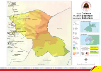
Lo’o Dasi ist ein osttimoresischer Ort im Suco Colimau (Verwaltungsamt Bobonaro, Gemeinde Bobonaro). Das Dorf liegt im Nordwesten der Aldeia Lo’o Dasi, auf einer Meereshöhe von 1014 m. Hier befindet sich auch das Zentrum der Aldeia.[1] Das Gebiet wirkt wie ein Anhängsel am restlichen Suco Colimau und kam erst 2015 vom Suco Maliubu zu Colimau.[2]
Durch den Ort führt die Überlandstraße von Maliana nach Atsabe. Nordöstlich liegt an ihr das Dorf Maliubu und westlich der Ort Hatu-Udu.[1]
Einzelnachweise
- ↑ a b Direcção-Geral de Estatística: Atlas der Gemeinde Bobonaro ( vom 14. August 2022 im Internet Archive).
- ↑ Timor-Leste GIS-Portal ( vom 30. Juni 2007 im Internet Archive)