Lloyd Hill
| Lloyd Hill | ||
|---|---|---|
| ||
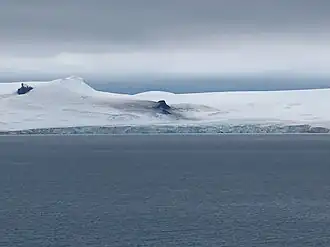
| Der Lloyd Hill zwischen dem Alzek-Nunatak (Bildmitte) und dem Kotrag-Nunatak (ganz links) | ||
| Höhe | 335 m | |
| Lage | Greenwich Island, Südliche Shetlandinseln | |
| Gebirge | Dryanovo Heights | |
| Koordinaten | 62° 29′ 24″ S, 59° 53′ 26″ W | |
| ||
| ||
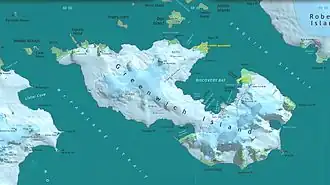
| Karte von Greenwich Island mit dem Lloyd Hill (linke Bildhälfte) | ||
Der Lloyd Hill ist ein 335 m hoher Hügel auf Greenwich Island im Archipel der Südlichen Shetlandinseln. Er ragt südwestlich des Mount Plymouth in den Dryanovo Heights auf.
Das UK Antarctic Place-Names Committee benannte ihn 1961 so, um die durch Henry Foster 1820 vorgenommene Benennung von Greenwich Island als Lloyd’s Land zu bewahren.
Weblinks
- Lloyd Hill. In: Geographic Names Information System. United States Geological Survey, United States Department of the Interior, archiviert vom (englisch).
- Lloyd Hill auf geographic.org (englisch)