Carney (Maryland)
| Carney | |||
|---|---|---|---|
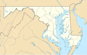
Lage in Maryland
| |||
| Basisdaten | |||
| Staat: | Vereinigte Staaten | ||
| Bundesstaat: | Maryland | ||
| County: | Baltimore County | ||
| Koordinaten: | 39° 24′ N, 76° 31′ W | ||
| Zeitzone: | Eastern (UTC−5/−4) | ||
| Einwohner: | 29.363 (Stand: 2020) | ||
| Haushalte: | 13.163 (Stand: 2020) | ||
| Fläche: | 18,1 km2 (ca. 7 mi²) davon 18,1 km2 (ca. 7 mi²) Land | ||
| Bevölkerungsdichte: | 1.622 Einwohner je km2 | ||
| Höhe: | 108 m | ||
| FIPS: | 24-13325 | ||
| GNIS-ID: | 0589899 | ||
Carney ist ein Gemeindefreies Gebiet und ein Census-designated place im Baltimore County im US-Bundesstaat Maryland. Nach der Volkszählung von 2020 gibt es 29.363 Einwohner auf einer Fläche von 18,1 km². Carney liegt nahe Baltimore und Towson und wird von der Interstate 695 und der Maryland State Route 147 tangiert.
Bildung
Carney hat mehrere Schulen:
- Carney Elementary School
- Harford Hills Elementary School
- Pine Grove Middle School
- Loch Raven High School
- Parkville High School
Weblinks
Commons: Carney (Maryland) – Sammlung von Bildern, Videos und Audiodateien
| CDPs |
Arbutus • Baltimore Highlands • Bowleys Quarters • • Catonsville • Cockesville • Dundalk • Edgemere • Essex • Garrison • Hampton • Honeygo • Kingsville • Lansdowne • Lochearn • Lutherville • Mays Chapel • Middle River • Millford Mill • Overlea • Owings Mills • Parkville • Perry Hall • Pikesville • Randallstown • Reisterstown • Rosedale • Rossville • Timonium • Towson • White Marsh • Woodlawn |