Boulogne-sur-Helpe
| Boulogne-sur-Helpe | ||
|---|---|---|
.svg.png)
|
| |
| Staat | ||
| Region | Hauts-de-France | |
| Département (Nr.) | Nord (59) | |
| Arrondissement | Avesnes-sur-Helpe | |
| Kanton | Avesnes-sur-Helpe | |
| Gemeindeverband | Cœur de l’Avesnois | |
| Koordinaten | 50° 5′ N, 3° 54′ O | |
| Höhe | 144–207 m | |
| Fläche | 8,70 km² | |
| Einwohner | 294 (1. Januar 2022) | |
| Bevölkerungsdichte | 34 Einw./km² | |
| Postleitzahl | 59440 | |
| INSEE-Code | 59093 | |
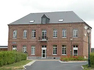 Mairie Boulogne-sur-Helpe | ||

Boulogne-sur-Helpe ist eine französische Gemeinde im Département Nord in der Region Hauts-de-France. Sie gehört zum Kanton Avesnes-sur-Helpe im Arrondissement Avesnes-sur-Helpe. Die Bewohner nennen sich Boulonnais oder Boulonnaises.
Geografie
Die Gemeinde Boulogne-sur-Helpe liegt an der Helpe Mineure, 22 Kilometer südlich von Maubeuge und 18 Kilometer westlich der Grenze zu Belgien. Die Nachbargemeinden sind Haut-Lieu im Norden, Étrœungt im Südosten, Floyon im Südwesten und Cartignies im Westen.
Bevölkerungsentwicklung
| Jahr | 1962 | 1968 | 1975 | 1982 | 1990 | 1999 | 2008 | 2013 | 2020 |
| Einwohner | 406 | 387 | 346 | 315 | 319 | 317 | 322 | 322 | 325 |
| Quellen: Cassini und INSEE | |||||||||
Sehenswürdigkeiten
- Kirche Mariä Himmelfahrt
-
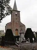 Kirche Mariä Himmelfahrt
 -
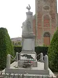 Gefallenendenkmal
Literatur
- Le Patrimoine des Communes du Nord. Flohic Editions, Band 1, Paris 2001, ISBN 2-84234-119-8, S. 130–131.
Weblinks
Commons: Boulogne-sur-Helpe – Sammlung von Bildern